When Everything Can Be Mapped, Maps are Everything
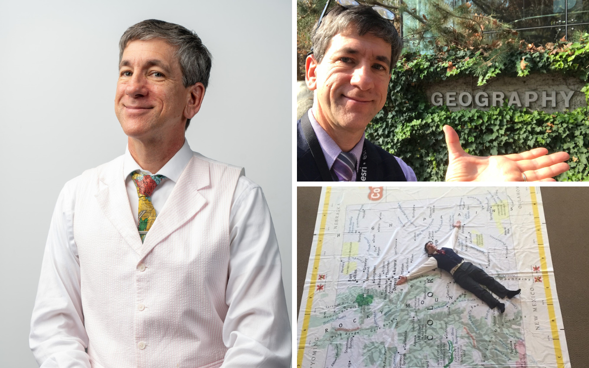
Joseph Kerski is hard to miss. He most often wears a sharp navy vest, boldly colored glasses, and an animated, bouncing enthusiasm for what he does. Kerski wants you to adore maps as much as he does.
“Place matters,” Kerski says. “Maps aren’t just relevant; they are increasingly relevant as we have an increasingly complex world. People say a picture is worth a thousand words. Well, a map is worth a thousand pictures.”
Kerski will teach “Mapping the Future” for DU’s Enrichment Program on September 9 and 16, in which he’ll explore both the long history of maps and their dazzling future. The Enrichment Program offers an array of short courses like this one, open to any community member with a sense of curiosity. Classes are offered in the evenings or via Zoom, with no tests or grades – just learning for the love of it.
Kerski is a perfect Enrichment Program instructor, as someone who is happiest talking about their area of expertise. In Kerski’s case, its geographic information systems, or GIS.
“As a child, I liked to do three things: get outside, take pictures (usually looking down from a high place), and make maps,” says Kerski, who grew up on the Western Slope of Colorado. “I also had an early instinct for conserving these natural resources. I had this sense of wanting to do my part to make the planet a better place to be.”
Today, Kerski holds his dream job. As Education Manager for the country’s leading mapping software company, Esri, he travels the country to cheerlead for GIS education and advancement. He spends his days evangelizing for GIS with students and educators, industry groups, nonprofits, government agencies and other entities. He is also a key adjunct faculty member for DU’s GIS master’s degree program.
“Maps are not just reference documents that state where things are. They’re analytical tools; they’re decision-making tools. They can tell us why things are the way they are, and how we can build a more resilient world,” he says.
He issues a litany of questions that can be answered with maps: Where do tornadoes tend to hit over a 100-year span? When a bus breaks down, how many people are on it, and what’s the quickest way to get another bus to them? How do infectious diseases spread through a population? How fast are invasive species entering a habitat? Whose home is threatened by the growth of a certain wildfire? How is income changing over time in various countries?
“All these issues, they’re all spatial,” Kerski says. “Sometimes mapping confirms our preconceived notions, and sometimes maps shatter our ideas of how the world works.”
Kerski promises his Enrichment Program class will be full of interactive moments, hands-on activities, and maybe a few puns. He keeps the energy of the class up and ties his content to what’s happening in the news to illustrate how new maps continue to be needed, long after the Age of Exploration. Students will even get the chance to use digital tools to create their own maps of personally significant spots.
“Enrichment courses are great because everybody is there just because they want to be; they want to learn something and they’re engaged,” Kerski says. “And there’s this wide variety of ages and backgrounds, which is great. I try to tie the class content to everybody’s experience, whether they’re a lawyer or a rancher.”
If you want the chance to learn about maps from this enthusiastic mapping expert, bookmark the Enrichment Program page for July 8, when registration opens for the fall term. You can also sign up for the Enrichment Program newsletter at UniversityCollege.DU.edu/Contact-Us/Enrichment-Program.
For those wanting a deeper dive into the world of GIS and spatial analysis, Kerski also co-teaches courses for DUx, DU’s online accelerated programs (open to all) that can be leveraged toward a micro-master’s certificate or even a full master’s degree through DU’s University College.
Comments
Leave a Reply
-
August 2, 2024
Two Pillars of Technology Leadership: Mission Clarity and Talent Management
Tech exec, Denver city leader, and DU instructor Al Gardner shares a guest post on what he sees as two key elements of technology leadership.
-
June 26, 2024
Guest Post: It’s Time to Get Savvy on AI Use and Security Risks
Unless AI end-users and employees are well educated on appropriate AI use, it’s increasingly likely that AI-driven vulnerabilities will be exposed.
-
June 7, 2024
Enrichment Classes Offer Taste of Cutting-Edge Research
With the free R1 Series within the Enrichment Program's slate of short noncredit classes, you can get a taste of DU's prominent research activity.
-
April 15, 2024
DU Supply Chain Expert Sets Forth Climate Change Solutions in New Book
A new book from Supply Chain Management Program Director Jack Buffington tackles the immense problem of climate change with some innovative thinking.
Give my Best wishes to Joe, haven’t seen him in approx 24 years when we collaborated on a teacher project when I worked for CTLT.