GIS Technology Plays Key Role in Preserving History and Research
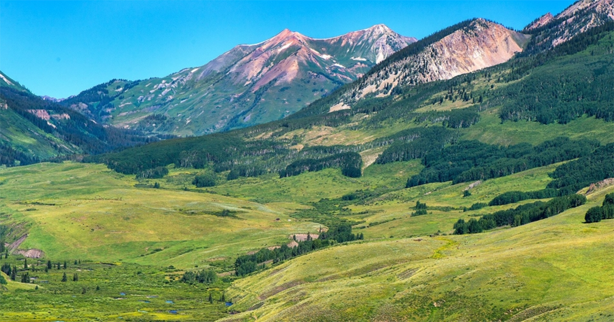
Gothic, Colorado just outside of Crested Butte, was once a booming mining town teeming with prospectors bent on striking it rich in the surrounding ore-filled mountains. But when the silver ran dry and the miners packed up and headed on to the next claim, something just as valuable as the ore moved in: research.
For almost a century, the Rocky Mountain Biological Laboratory (RMBL), located at the Gothic site and the area beyond, has been a worldwide leader in climate and environmental research. Since it moved into the abandoned mining town in 1928, the internationally renowned research center has hosted thousands of scientists and students who have made the ecosystem one the most intensely studied in the world. More than 1,900 publications have come about as a result of RMBL research on climate, wildlife, ecology, and much more.
Because of the RMBL’s impact on our history, our present, and our future, it was recently granted a conservation easement by Colorado Open Lands, ensuring that the area is protected and research will continue unencumbered.
Critical to that designation was the use of Geographic Information Systems technology to map research plots, important boundaries, historic structures, and more to help prove the case for conservation.
Stacking Skills for Expertise
At the heart of the RMBL’s GIS data is University College at the University of Denver’s GIS program alumna and faculty member Shannon Sprott, who also serves as the RMBL’s GPS/GIS Coordinator. Her GIS experience, education, and enthusiasm helped to ensure that the RMBL will remain one of the world’s most diverse research centers for years to come.
Sprott is a perfect example of how taking an interest to the next level through stacking graduate credentials can take a career to the next level.
While studying undergraduate environmental biology and ecology at Western Colorado University in Gunnison, she took her first course in GIS in 2001. The course and her interest in staying in the Gunnison area after graduation led her to taking an GIS internship with Gunnison County in 2002, where she provided help with mapping.
Sprott initially taught herself to use ArcMap software and look for data sets that helped with a variety of county projects. Her internship eventually turned into a full-time position.
“I just ended up loving it. I’m a planner person, and I don’t like doing the same thing 8 hours a day. When I started doing mapping, I was doing something different every hour,” she said.
When the time came to advance in her career with the county, she sought out education to build more skills in GIS.
“The only way to move forward was to get more education, and I decided to take the University College GIS graduate certificate program online,” Sprott said, adding that earning the certificate from DU in 2006 helped her get reclassified to a higher position with a better salary.
It also laid the foundation for her to quickly earn her Master’s in GIS when the University of Denver started up the online master’s program in 2009.
“I was one of the first people to take the online master’s program,” she said. “My GIS certificate credits transferred over into the master’s program because I stayed with the University of Denver. Because of that, I only had just over a year left of classwork.”
Sprott was also able to immediately apply skills she learned from her courses to her career. As part of her capstone course, she created a 911 addressing database for Hinsdale County, a mapping project that hadn’t existed prior, was very needed in the area for quick emergency response, and which the county ended up purchasing from her for use.
Today, it has all come full circle for Sprott, from student to instructor. In addition to her work at the RMBL, she started teaching a variety of courses at University College in 2012, including Intro to GIS and Geodatabase Applications. In her role as an instructor, she gives students a chance to hit the ground running with the technology through her years of experience in the field.
“I just want people to get more comfortable in dealing with data and organizing data, as well as working with new software. It’s not easy throwing yourself into something new,” she said.
Using GIS in Support of Science
Thanks to Sprott’s love and knowledge of GIS, not only has she made an impact on her students but she also has made an impact on the scientific community of RMBL. She began working with the RMBL on special projects while still working with Gunnison County, and eventually took an employee position with the research center, allowing her to teach courses at DU and Western State.
Sprott creates maps for virtually everything on the Gothic property. For example, she has mapped out improvements, like sewer and septic lines, that help with maintenance of the property. She can even map out where butterflies have landed during a pollinator study using data from researchers’ GPS units.
Currently, there are around thousands of research sites that have been mapped out with more being added all the time. Because the studies have very specific environmental needs, Sprott uses the vast amount of data collected at Gothic to map out the plots that will meet those requirements.
“We have a very extensive data base, including maps and data sets that date all the way back to 1928,” she said, adding that the year-round caretaker of Gothic, billy barr, has himself been collecting climate data there for decades. “It’s all about research, it’s all about science and it’s all about sharing that with the public.”
Preserving Gothic for Generations Through GIS
Research done at Gothic has influenced legislative policy, management best practices, and understanding of ecological processes across the world. Not only is new research happening regularly, the site has also generated decades and decades of data from the same studies, which is a rarity in science.
Research on acid deposition was used during revision of the National Clean Air Act. Pioneering research on pollination began at RMBL in the 1970s with scientists who continue to research in Gothic every summer.
But the land is valued for more than just its wealth of research opportunities. It is also in a sought-after area in the state, is bordering Crested Butte winter recreation areas, making it vulnerable to real-estate development.
Seeing how decades of past and future research and data were at stake, the RMBL was able to protect Gothic and the entire 270-acre site under a conservation easement with Colorado Open Lands in the summer of 2020.
Getting the easement required proving that there was enough ecological and conservation value to preserve Gothic forever. That is where GIS played a critical role. Using the years and years of RMBL data, Sprott was able to create a variety of maps, including topography, soils, natural features, facilities, wetlands, as well as buildings of historical value, long-term research plots, and more.
Thanks to those maps and the hard work of RMBL staff, research can now take place indefinitely, keeping science alive in well in the high country of Colorado without the threat of development.
“People say a picture is worth a thousand words, but I say a map is worth 1,000 pictures,” said Sprott.
To learn more about the University of Denver GIS graduate offerings (and to take a course from Sprott), please visit the program’s website. You can learn more about Gothic and the research there on the RMBL website.
Photo courtesy of RMBL.org.
-
March 27, 2024
Denver Airport Spokesperson Credits her Communication Management Master’s
Ashley Forest's master's degree in Communication Management from University College propelled her career to new heights.
-
March 5, 2024
Nanette Lockwood Takes Big Swings at Fighting Climate Change
Nanette Lockwood has held high-level positions advocating for better environmental laws and regulations in the U.S. and abroad. Now she's equipping new professionals to do even more.
-
March 1, 2024
Q&A: Communication Management Program Looks Constantly Ahead
Academic Director Dr. Cindy Cragg keeps her finger on the pulse of the communications field in order to ensure the program stays cutting-edge and relevant to professionals in the industry.
-
February 2, 2024
For Great ROI, Invest in Yourself
If you’re seeking to expand your horizons, a University College credential can give you an exceptional education and help you stand out.